Bahria Enclave & Margalla Orchard Map PDFs
The CDA-approved layout plan and FGEHA’s Margalla Orchard plan, hosted as downloadable files — no form, no email — plus how to read one.
Both plans below are the authorities’ own approved documents, hosted here as files you can download. No form, no email address, no “request a callback”. They are large because they are the real sheets, not screenshots.
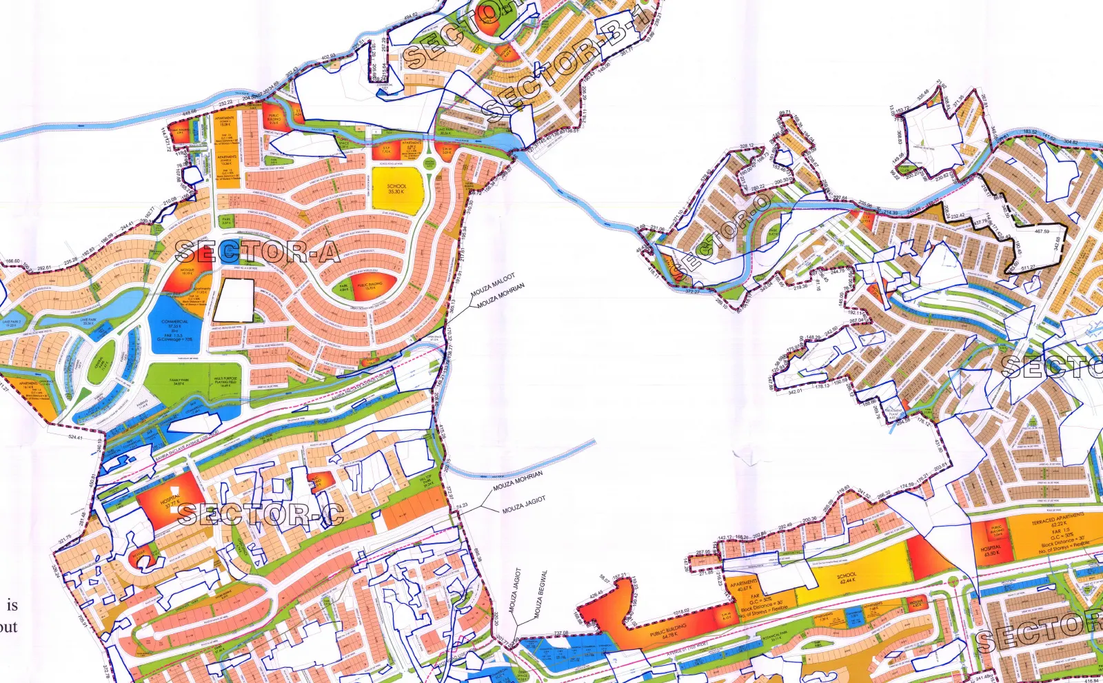
Bahria Enclave layout plan
The As-Built / Proposed Layout Plan for Bahria Enclave, scale 1:4,000, signed by the town planner. Every sector, the civic zone, parks — and the parcels the plan itself marks as outside the approved layout.
Download the PDF · 14 MB Lighter image version · 0.7 MB Open the pan-and-zoom viewer instead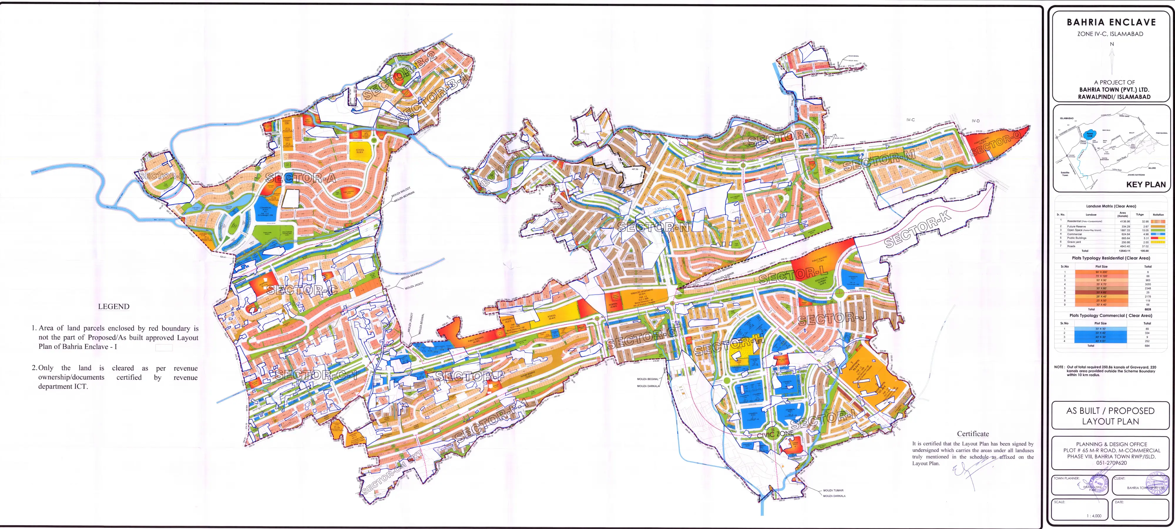
Margalla Orchard layout plan
FGEHA’s own approved layout plan for the Park Road scheme, prepared by NESPAK, A0 sheet. It carries the plot schedule the whole market quotes second-hand — 4,781 plots, block by block.
Download the PDF · 4.6 MB Open the pan-and-zoom viewer insteadWhat you are actually downloading
This is the distinction that costs people money. A society’s marketing map and its approved layout plan are two different documents, and they do not always agree. The marketing map is drawn to sell; the approved plan is the one an authority signed, and it is the one that decides whether a plot legally exists where a seller says it does.
- The approved plan shows exclusions. On the Bahria Enclave sheet, several boundary-enclosed parcels are marked by the plan’s own legend as not part of the approved layout plan. They still get sold. They do not appear as excluded on any brochure.
- It shows what land is reserved for. Parks, green strips, graveyard, school and hospital plots are drawn and labelled. That matters because converting them and selling them as residential plots is the single most common allegation in CDA’s 2025–26 enforcement notices.
- It is dated and signed. A plan without a date and a signature is a drawing.
How to read it in five minutes
- Find your plot’s sector and street on the sheet before you look at anything else. If you cannot locate it, that is the finding.
- Check the colour and the legend for that parcel. Residential, commercial, amenity, or excluded — the legend tells you which.
- Look at what is next to it. A plot backing onto a nullah, a high-tension line or a graveyard is priced differently by the market and rarely described that way by the seller.
- Compare it to what you were shown. If the seller’s map has streets the approved plan does not, ask which revision they are working from — and whether that revision has its own NOC.
- Then check the scheme’s status in the society checker. Plan plus status is the whole picture; either alone is half of it.
Where these came from. The Bahria Enclave sheet is CDA’s approved layout plan for the scheme; the Margalla Orchard sheet is published by FGEHA at fgeha.gov.pk. We downloaded both, rendered them readably and host them so they cannot quietly disappear. If an authority publishes a newer revision, that becomes the document that matters — ask for it by date.
Reading the real sheet
Directly from this page — the CDA-approved As-Built and Proposed Layout Plan, 14 MB, with no form and no email required. There is also a lighter 0.7 MB image version and a pan-and-zoom viewer if you would rather read it in the browser than download it.
No, and the difference is the point. The marketing map is drawn to sell; the approved layout plan is the one an authority signed and dated. On the Bahria Enclave sheet, several boundary-enclosed parcels are marked by the plan's own legend as not part of the approved layout — plots inside them still get sold, and no brochure shows them as excluded.
Four things: that your plot is on the sheet at all; what the legend says that parcel is for (residential, commercial, amenity, or excluded); what sits next to it — a nullah, a high-tension line, a graveyard; and whether the plan you are holding is the current revision. If the seller's map shows streets the approved plan does not, ask which revision it is and whether that revision has its own NOC.
Found your plot on the plan — or could not?
Send me the sector and plot number with a photo of the seller's map. You get back where it sits on the approved plan, and what the legend says that land is for.
Maps, distances and addresses
- Location & mapWhere it sits in Zone IV, the live map, and the routes in.
- Approved layout planCDA’s own plan, digitised — sector by sector, including the parcels it excludes.
- Distances & drive timesAirport, Blue Area, Faizabad, Zero Point — km and off-peak minutes.
- Postal code & addressWhat couriers actually accept, and why directories disagree.
- Margalla AvenueThe road that decides the drive — status, not brochure promises.
- Living thereSchools, hospital, water, power — day-to-day reality.
- All 16 sectorsCompared on price, development stage and what each is actually for.
- “Bahria Enclave 2”A different scheme in a different place. Do not confuse the two.